Forensic Analysis: Decoding Quarry Landscapes
Tuning forgotten data into actionable intelligence through adaptive analysis
Kelleys Island, Lake Erie Archipelago, Ohio | 2023–2025
In the abandoned East Quarry on Kelleys Island in the Lake Erie Archipelago, century-old blast piles quietly held evidence of complex decisions. I used precision image analysis to extract size trends and spatial rhythms, revealing how early crews advanced through the site and where their choices left lasting marks in stone.
Project Brief
My goal in the century-old East Quarry was to map, model, & decode the hidden logic of extraction to build a clear understanding of an otherwise poorly documented site.
I surveyed twenty key sites along a transect on foot and by small-engine plane, and then applied precision image segmentation using Hexagon Split Desktop software to isolate fragment fields and determine how size distribution in the piles related to pile locations across the boundary of the quarry.
These off-the-shelf tools, while designed for mine and quarry analysis, were repurposed to uncover high-resolution environmental histories, an example of retooling existing platforms to uncover new historic insights.
From those fragments I built morphological layers, inferred machine routes, and constructed a structural timeline.
My process made legible the dynamic operational narratives that had gone unnoticed for nearly one hundred years by reading the subtle traces left behind in static piles of stone.

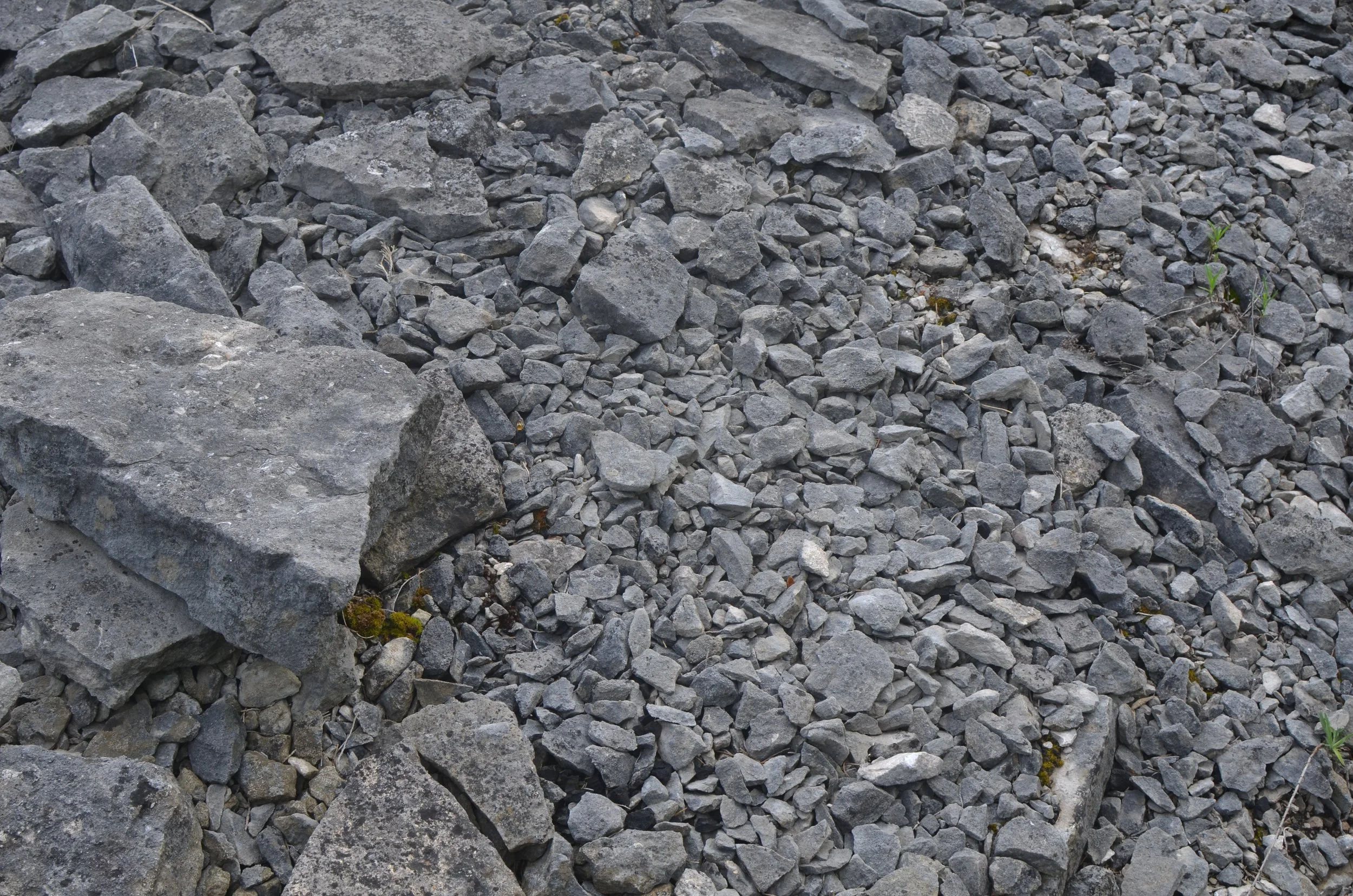
From Debris to Data: Image Analysis
Each frame shown here captures a layer of computational analysis used to infer debris sorting, tool application, & sequencing in long-abandoned extraction zones (for complete image set, request the full report at the end of this page):


Visualizations produced using Hexagon Split Desktop, a commercially available tool used for particle size distribution analysis.
The East Quarry study generated a spatial intelligence model from detailed image analysis of blast debris. By measuring size distribution and identifying residual material patterns, I reconstructed sequences of quarrying activity and the embedded logic behind site operations. This work translated static remnants into operational narratives, revealing workflows, toolpaths, and extraction strategies encoded in the terrain itself. The result is a usable framework for analog field testing, ISRU scenario planning, and comparative analysis in overlooked or legacy sites. It demonstrates how repurposed commercial tools can surface actionable insight where standard analysis sees only abandonment.
Systems & Outcomes

Produced using Hexagon Split Desktop
Foresight from the Edge
Extending the reach of COTS analytics to surface long-buried sequences of action.
I specialize in finding and solving the edge cases that commercial software typically overlooks, pulling extra value out of ready-made tools by uncovering new sources of data. At East Quarry, I took a tool meant for live production analytics and used it to decode century-old blast patterns, transforming leftover stone into a record of industrial behavior. By adapting standard platforms to unconventional domains, I build predictive frameworks from overlooked data sources, turning forgotten debris into untapped resources and uncovering strategic foresight from the margins of usability.
Dig Deeper into the Operational Memory of East Quarry.
Request the full Decoding Quarry Workflows report, complete with raw data tables, segmentation protocols, composite visualizations, and interpretive commentary.
Whether you’re in agriculture, infrastructure, heritage, or planetary analogs, I would like to help you define the hidden value in your edge cases.
