14. THE GRANITE WAS NOT THE OBJECTIVE

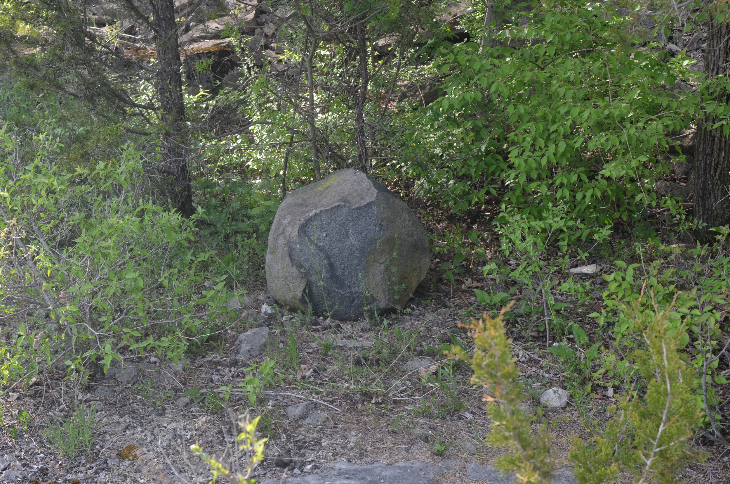
Over the years I’ve found it puzzling that there are so many glacial erratics in the abandoned limestone quarries on Kelleys Island. Many of these erratics are granite, but tillite, quartzite, diorite, gabbro, gneiss are also found, among others. If you knew nothing about rocks, these erratics would stand out to you because the colors of these stones contrast with the consistent gray of the limestone bedrock in the quarry. The pink stone in the image above is an erratic, the gray stones filling the foreground are pieces of local limestone broken up during quarrying. The color contrast is an immediate clue. What puzzles me is why these stones were not removed during quarrying operations.
I’m attempting to highlight how the glacial geography of the region created the right conditions for logging, vineyards, and quarrying during the late 1800s to bring the island ecology to its current fragile state, and to think about what that means for the future of the island and the biodiversity in the Lake Erie basin.
Earlier this year I took a scouting trip to Kelleys Island to plan my activities for the next year. I visited a number of sites where I planned to return to map and catalog different elements of the landscape. To get a sense of the distribution and concentration of erratics on the island, I brought along a tally click counter and walked through the different quarries, clicking to count stones that were clearly out of place.
Because I’ve spent so much time in the East Quarry, I knew I’d find hundreds of erratics, and on a brisk hike I counted 249 in just one small section of that quarry. But I did not expect what I found in the 59-acre Huntley-Beatty preserve (located south-west and closer to town); in two hours I had only counted seven erratics in that quarry.

I started forming hypotheses that I would begin testing out over the next several months, and I went home, prepared my data notebooks, and set out to start mapping on my next trip.

After 3 days of mapping, collecting the GPS coordinates of the erratics, and making notes about the roundedness, size, color, texture, and type of stone, I’ve completed 30% of the quarry and logged 150 erratics.

At this point it might be useful to explain why this matters to me. Over the last two years as I’ve been trying to pinpoint the Canadian Shield source outcrop for the 38lb granite glacial erratic I found in Ohio as part of my expedition project This Stone Wants To Go Home, I’ve talked to geologists in three countries about ice flow directionality and the movement of erratics. More than half of these geologists have told me that it’s not interesting to trace the movement of a glacially displaced stone. As a trained scientist, I hear what they are saying: the discipline of geology is asking different questions now. But I’m not doing geology; I’m doing poetry.
What’s more is that I am looking at glacial erratics that have been moved by people after they had been moved by glaciers, so it’s more about human land use than it is about geology, and as a trained anthropologist I’m reading the traces to see if I can determine the decision-making strategies used daily in the historic limestone quarry operations on Kelleys Island regarding what to do with the hundreds of granite glacial erratics encountered in the process of extracting limestone from the landscape. Why were these erratics left behind? Why didn’t the quarry harvest these foreign stones?
I had a hunch about why these stones were ignored, and so I began to gather my data on this most recent trip to the island. Starting at the western-most edge of the quarry, I worked my way east conducting a box search, a classic search and rescue technique that moves in parallel lines back and forth incrementally moving across an area while progressing in one direction.

The erratics I found were interesting.


Here (above) is an example of stones moved by people after the quarrying operations had shut down. These igneous rocks were laid out in a circular pattern near the north-western edge of the quarry. I’m less interested in rocks that have been moved in contemporary times and instead more interested in rocks that were moved when the quarry was operational. So while I included these rocks in my inventory, I’m not factoring them into the pattern matching for looking at the distribution of stones in linear patterns.

This wheelbarrow has been in this quarry for at least the 15 years that I’ve visited the island (if not longer), and I’ve noticed it move from time-to-time. Initially I came across it during hunting season and I assumed it belonged to a hunter who would use it to move deer out of the quarry. Now I’m wondering if maybe it’s being used to move stone and aggregates around during the construction of walking and bike paths through the quarry.
For as long as I can remember, there has been a pile of rusty metal objects in the quarry which I presume to be artifacts of the quarrying operations. I always liked looking at this pile because so many of the objects are still recognizable. I’ve taken several photos of this pile over the years, and in April I took this photograph:

When I came back three weeks later, I was startled to see the entire pile had been cleared away. Perhaps the wheelbarrow had something to do with this removal operation.

I continued mapping and photographing erratics.


I’ve apparently never been to the quarry in May, because I had no idea how many lakeside daisies grew in the quarry. The bloom season is short, and seeing the landscape dotted with these yellow flowers proved to be a beautiful, but disorienting, experience. The lakeside daisy (Hymenoxys herbacea) grows in landscapes that most plants find inhospitable, so there is little competition between the daisy and other plants.
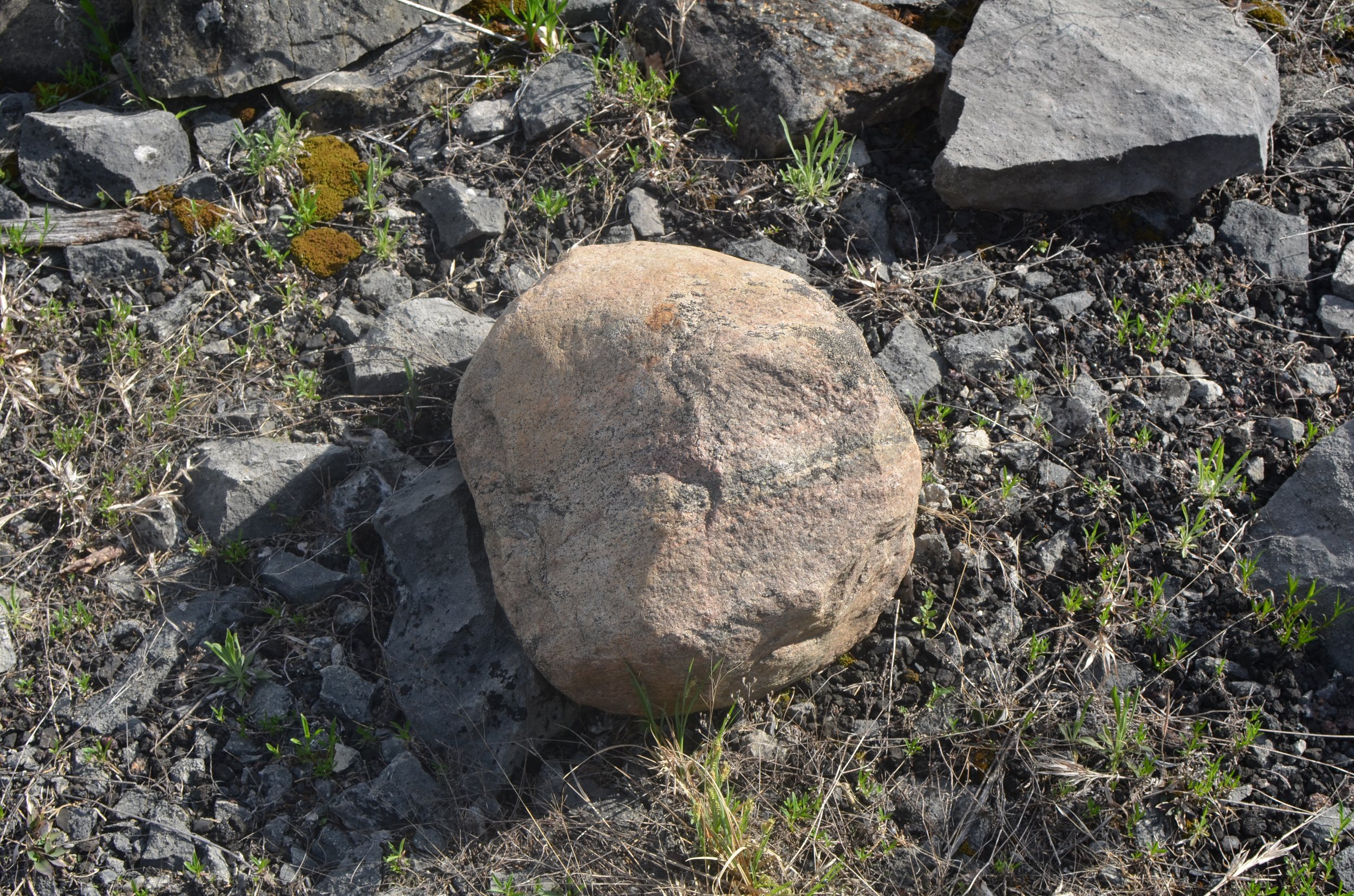
It rained during the second day of mapping and I was able to take photos of some of the rocks before and after the rain. I was curious to see if the contrast would be as stark across wet and dry conditions. Here are two photo of the same stone taken less than 24 hours apart:
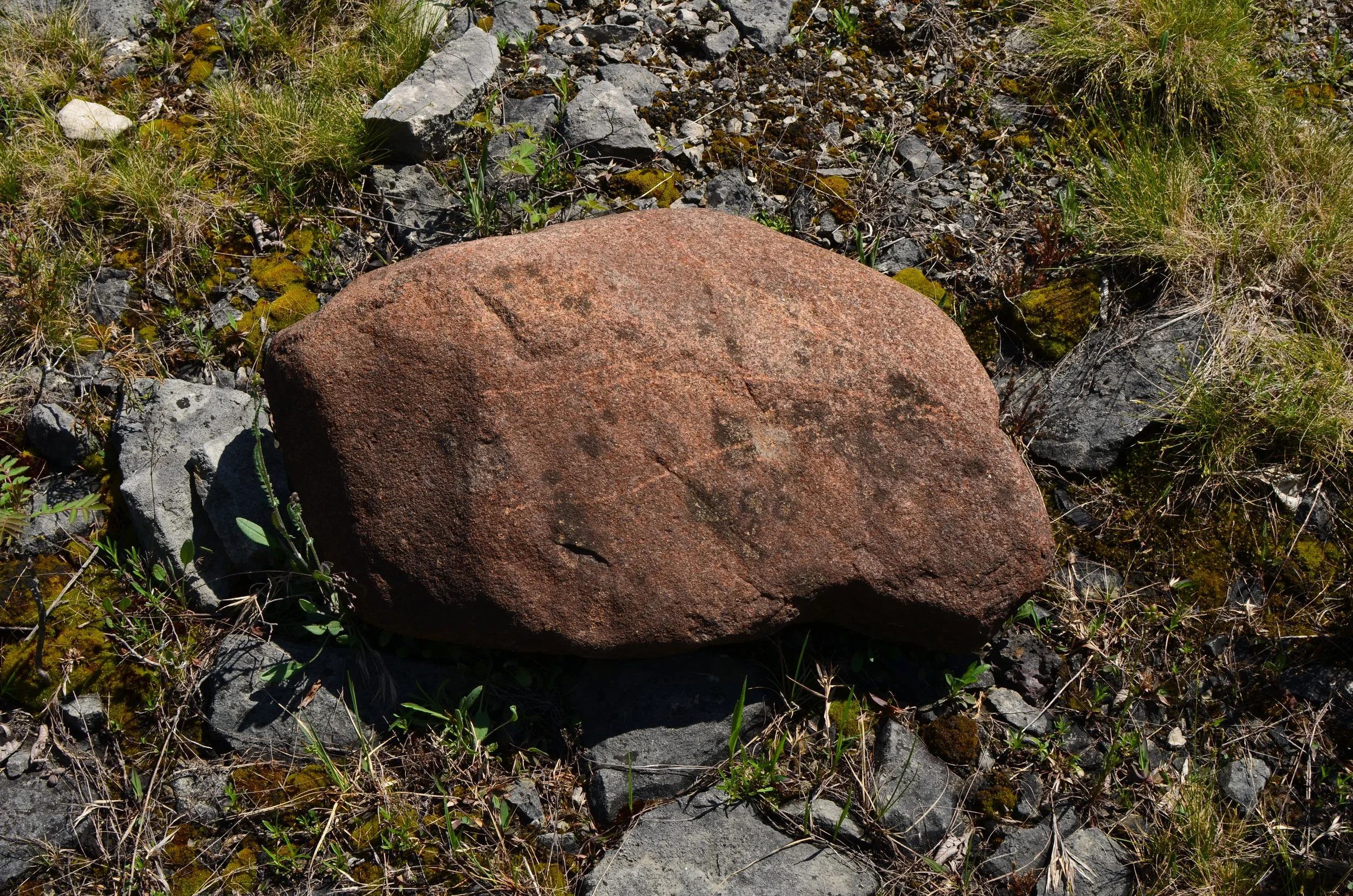

Features other than color also help to distinguish between quarried remnants and glacial erratics: roundedness of the rock, textures of the rock, patterning, size—but features can be deceiving, as in the case of weathered limestone that looks like an erratic but is not. Several times during this initial quick mapping I mistakenly started logging data about a stone that ended up being a piece of local limestone that had been weathered and rounded over the years. These imposter erratics fooled me, but as I worked to describe each of the rocks it became clear that I was wrong about the rock. Here’s a rounded limestone followed by a rounded tillite:


Knowing some history about the Kelley brothers and their approach to business, I have some thoughts about why the erratics were left behind. This doesn’t solve the mystery of why there is an abundance of erratics in the East Quarry vis-a-vis the absence of erratics in the Huntley-Beatty preserve quarry. In early June I took another trip to the island to continue mapping and to visit some of the other preserves in the area, and I met up with a local resident who was helping me ethically source some limestone from quarries that are not active preserves. I mentioned my hypothesis about the absence of erratics in Huntley-Beatty, that it’s surrounded by houses which possibly made it easier to pilfer erratics, compared to East Quarry which is surrounded by forests and parkland. He mentioned that another factor I should consider is the timelines of operations for the two quarries. Huntley-Beatty was much more recent in history compared to the East Quarry, and possibly details of the quarry operations may have become more efficient, and also possibly the granite erratics were now seen to have economic value, whereas the East Quarry was primarily focused on materials for lime kilns and raw material for flux in the steel mills. Either way, in East Quarry, the granite was not the objective. There is more to explore here, but I need to do some reading first.
In his book Geology In The Field, Robert Compton gives this advice about geologic mapping:
“Mapping is likely to be exploratory and deliberate until the principal rocks have become familiar and mapping units have been tested and proven. Visits to nearby mapped areas and to type sections of formations may need to complete this selection. When mapping becomes more rapid and systematic, it should be directed toward parts of the area that seem most likely to resolve the project’s major questions. As parts of the area are more or less completed, they can be checked by constructing cross sections through them. Recesses may be needed to do laboratory work on critical fossils or rocks.” (p7, Compton: 2016).
I’ve been concentrating my efforts now on the stones that were moved by quarry workers (and not contemporary land users), and I have typically found the erratics near the edges of the linear lines of operations running west to east in the quarry, so I’ve concentrated my search efforts to those runs of limestone piles where I find the erratics. Occasionally I’ll see an erratic that is situated between these limestone rows, but it seems that these row are more likely to help me resolve my questions, so I am going to try to move a little quicker through the remaining portions of the quarry.
…to be continued.