Lithological Reduction by Agriculture
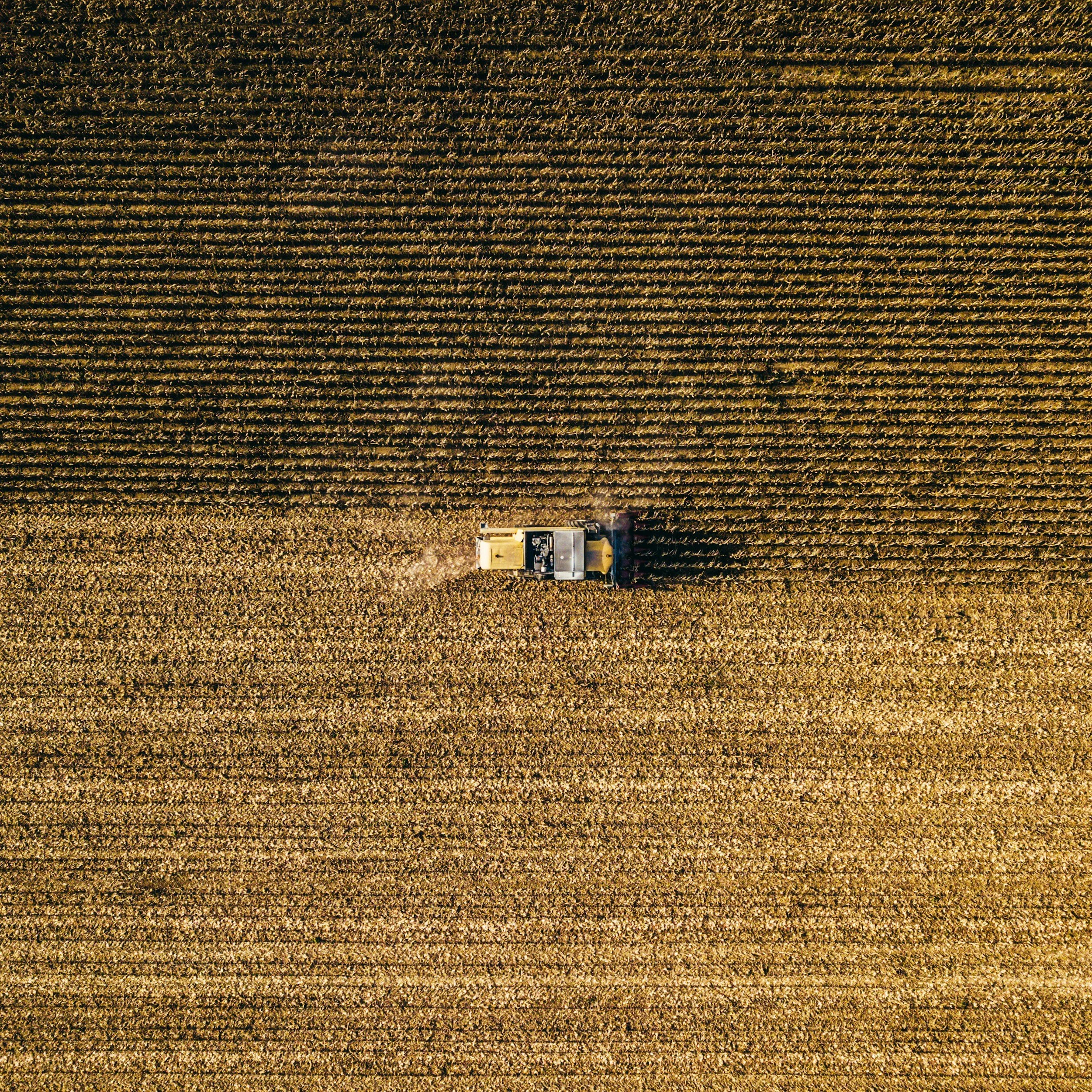
Clearance Cairns Survey – Huron County Unit, Ohio | 2018
CONTEXT
If you look closely, a plow-scratched stone at the edge of a cornfield tells a story far larger than agriculture. Season after season, as farmers till their fields, stones rise to the surface. These stones are fragments of a deeper archive that records both glacial transport and human disturbance. Most are cast aside into clearance cairns, quiet heaps scattered across the landscape. But each stone began its journey long before tractors and plows existed, carried south by glacial ice, locked in place for millennia, and finally dislodged by the blade of a contemporary machine. Their emergence marks not just the passage of time, but the layered imprint of glaciers, gravity, and progress.
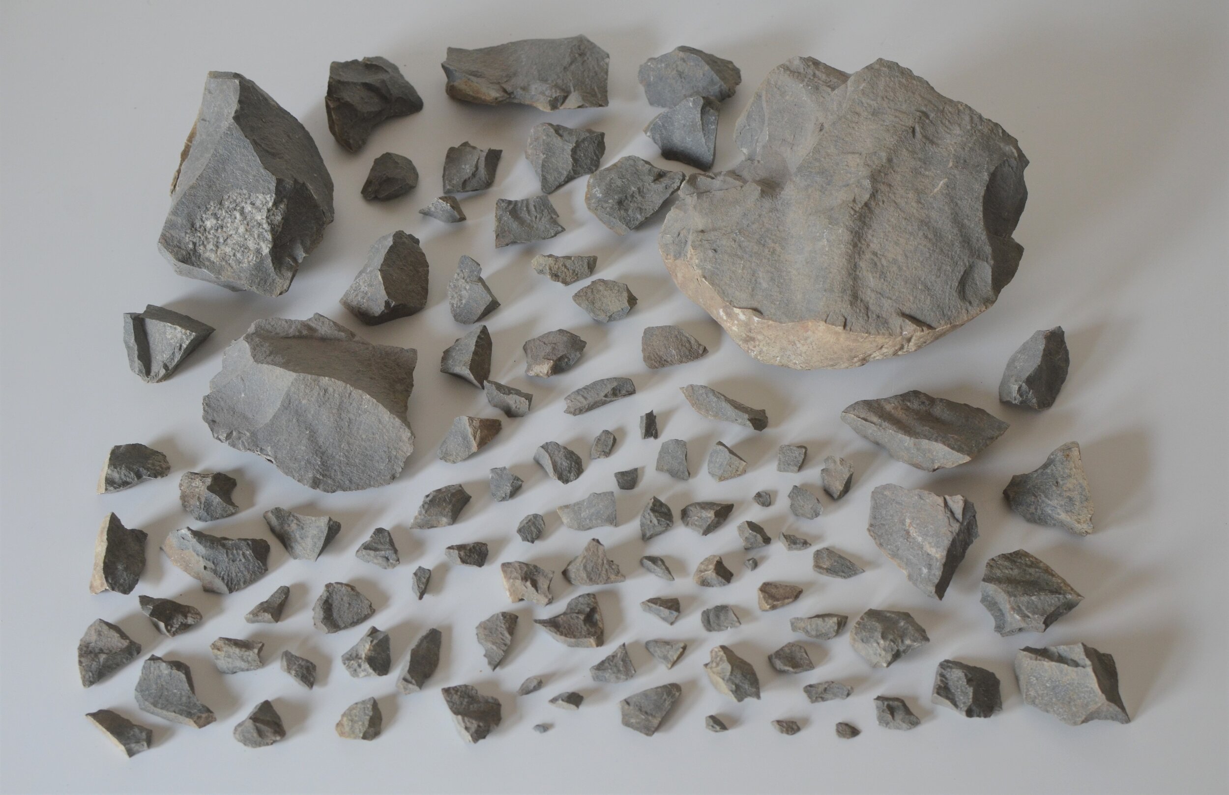
In this project, a single shattered specimen of Gowganda Tillite became a starting point for a larger investigation. I discovered the stone lodged beneath the soil of a small field in Huron County, Ohio, but the stone had already traveled roughly 450 miles south from its origin near the north shore of Lake Huron.
During routine tilling, this stone was struck by a plow and fractured into 97 pieces, becoming the perfect example of agriculturally-induced lithological reduction. I picked up every piece. Among the fragments, I noticed a piece of embedded diorite, indicating this tillite had a very traceable and distinct provenance.
project brief
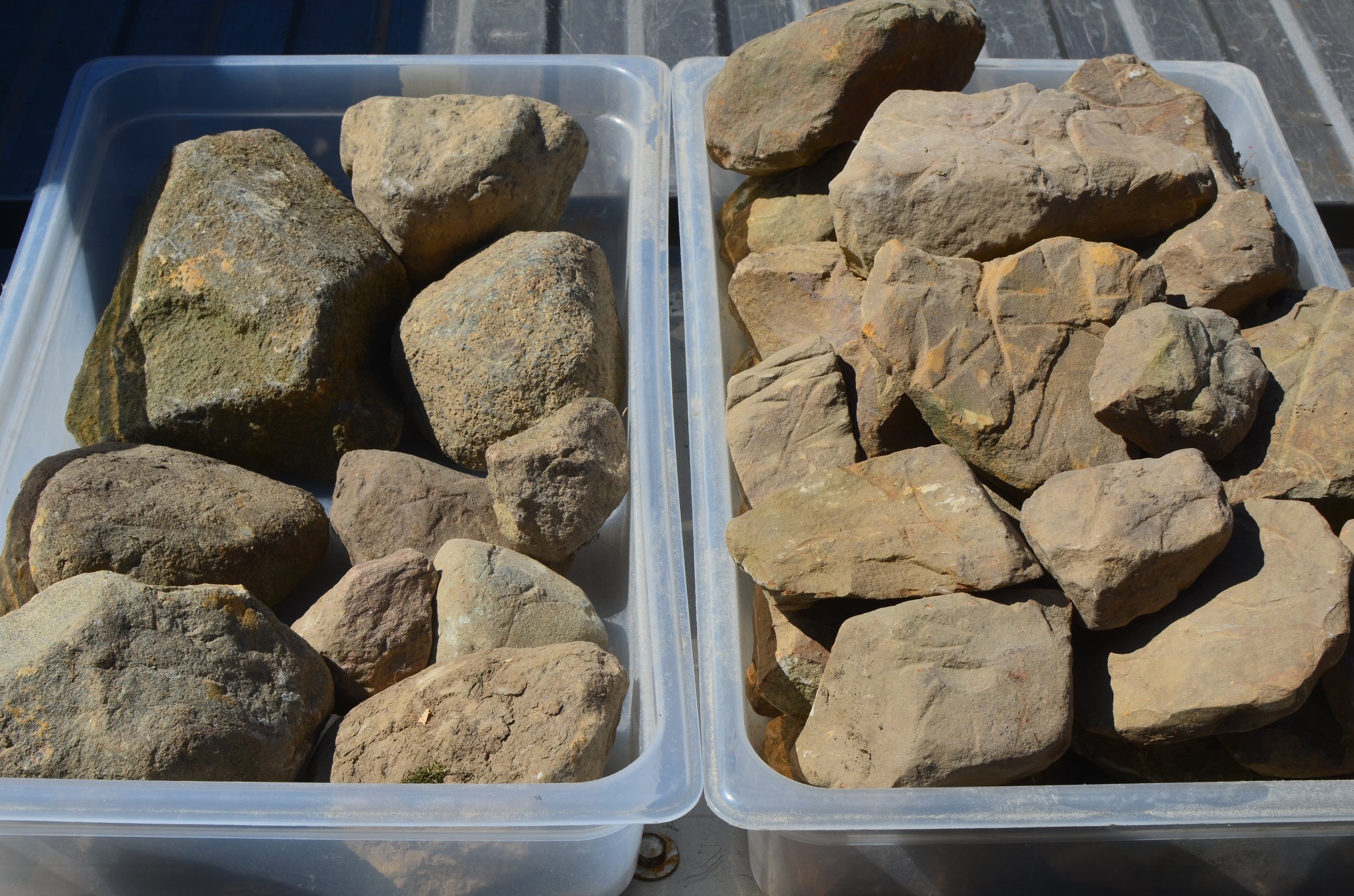
Building on this singular object, the ongoing inventory maps another 100 stones unearthed by annual tilling at the edge of the terminal moraine of the Laurentide Ice Sheet.
The collection includes a range of lithologies: sandstones, granites, gneisses, and limestones, all deposited in a single field by Pleistocene ice.
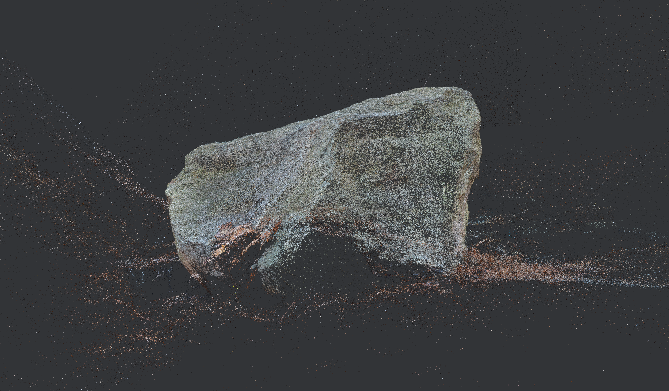
Each stone was analyzed for composition, roundness, and surface texture. These features, combined with reconstructions of ice flow direction, co-deposition evidence from the Gowganda Tillite, and regional lithology, allow for provisional origin mapping. Every stone is then tagged, photographed in 3D, and plotted on a map.
Insights & Outcomes
In post-glacial agricultural landscapes, the seasonal emergence of stones across a field can be read as a layered record of both glacial deposition and human interaction with the land. Each surfaced stone is part of a slow-motion geologic archive, reactivated through the repeated cycles of tillage and environmental lift. While these emergent patterns are often treated as a nuisance, they actually trace long-buried processes (both natural & operational) that shaped the terrain. When cataloged with attention to morphology, location, and frequency, these stones begin to narrate the underground structures they came from, offering insight into past geological forces and present-day land-use patterns.
Tools & Systems
Field Stone Classification Systems
processing stones upturned during tilling cycles in agricultural fields
Among the fieldstones scattered in the same farm field (turned up in a single tilling cycle) two distinct types co-occurred: angular, locally-derived sandstone clasts, and far-traveled, glacially-rounded igneous stones. After successive seasons of surfacing both local and distant stones, a broader picture came into view. These different types of stone traveled together, were deposited together, and worked their way to the surface together. The difference was distance, the more rounded the stone, the farther the distance traveled.
The implications extend beyond glacial reconstructions to press into how we train systems to see. I’m using these stones to refine a framework for machine vision classification that considers surface traits while incorporating embedded cues of process and origin. Rather than just labeling material or shape, I’m building an ontology that reads travel histories, depositional logic, and contextual co-occurrence. A system tuned not just to sort, but to notice like a field geologist’s eye trained through repetition and relevance. The goal isn’t to simulate human expertise, but to operationalize what the system pays attention to.
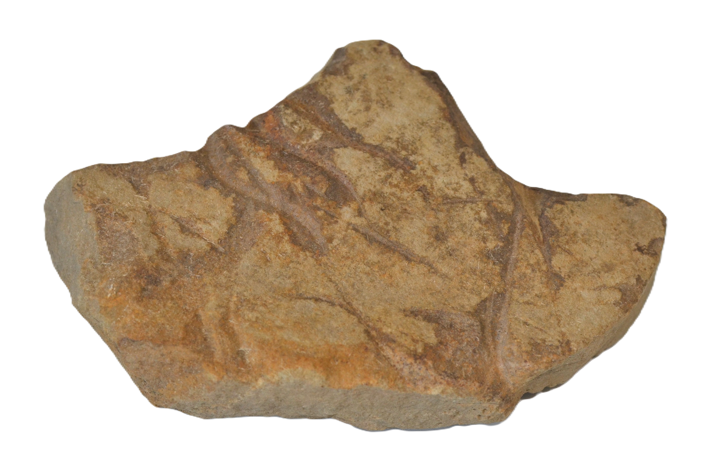

Locally-Derived Field Stone
Angular. Sourced from local lithologies, in this case, sandstones which occur 50 miles to the east of this field. Mohs hardness: 6, plow marks more pronounced.
Far-traveled Field Stone
Rounded. Sourced from distant parent rock (igneous), likely the Canadian Shield. Mohs hardness: 7, plow marks less pronounced.

Discovery Site: Farm Field
This emphasizes shared structural features or recurring silhouettes across the set. The value here is the capture of latent “shape memory” across the debris, extending the average to potentially index the erosion logic during glacial transport.
Machine Vision with FieldSense
This tool performs parametric image analysis to extract and classify geologic features from fieldstone photographs. This results in high-resolution differentiation across traits like roundedness, material type, and depositional signature.
Designed to support rock-related operations, it extends beyond surface traits to infer processual histories and co-occurrence patters, approximating expert-level geological reasoning at scale. The system is modular, tunable, and deployable for real-time or batch classification environments.
-
Modeled on real-world geological reasoning and tuned using comparative analysis of co-occurring local and far-traveled stones, field-sourced under controlled conditions. Designed to notice embedded evidence of transport, deposition, and material origin.
-
The system learns from your domain knowledge. Its modular framework integrates formal geologic categories with field-derived traits, allowing you to tune classification logic and interpretive bias over time.
-
Designed for both folder-dump batch processing and real-time edge execution. Ideal for deployment in several pipelines beyond autonomous rock sorting, or agricultural field analysis where contextual decision-making is key.
Field-Based Lithological Intelligence
This project is part of a broader effort to develop field-deployable frameworks for identifying, classifying, and recontextualizing displaced geological material in postglacial agricultural environments. The glacial erratics mapped here become active components in tuning new ontologies for material sorting, triage systems, and spatial memory in altered landscapes.
If you’re working on land reclamation, mineral resource models, or agricultural triage systems and want to integrate field-based lithological intelligence into your workflows, get in touch.