GEOCOG
Terrain Intelligence Systems

See the hidden value in the systems your land, operations, and data create.
I work with engineers, planners, and operational teams to uncover opportunities in landscapes, industrial sites, and the information those systems generate.
Through sustained field observation, interdisciplinary analysis, and careful interpretation, I reveal patterns, structures, and leverage points where terrain, operations, and data intersect. The result is actionable insight that guides durable decisions and long-term stewardship.
Case Study

Extending Terrain Intelligence Software into New Markets
Collaboration with Hexagon Mining
Year
2025
Context
I worked directly with Hexagon Mining and its global clients to demonstrate how terrain intelligence workflows developed for extraction industries could be extended into landscape planning, environmental analysis, and site development. Presented across two international client summits, the work showed how existing spatial analysis tools and operational datasets could solve complex planning constraints while opening new application areas for the platform.
Insight
Terrain intelligence platforms generate detailed spatial datasets through routine operational workflows. Much of this information contains analytical potential beyond its original purpose. By interpreting these datasets as landscape systems rather than purely operational outputs, new forms of environmental understanding and planning analysis become possible.
Application
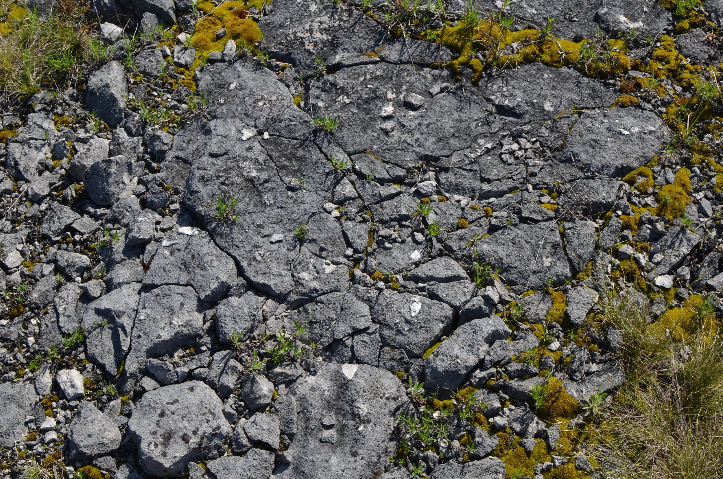
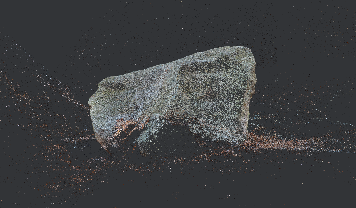
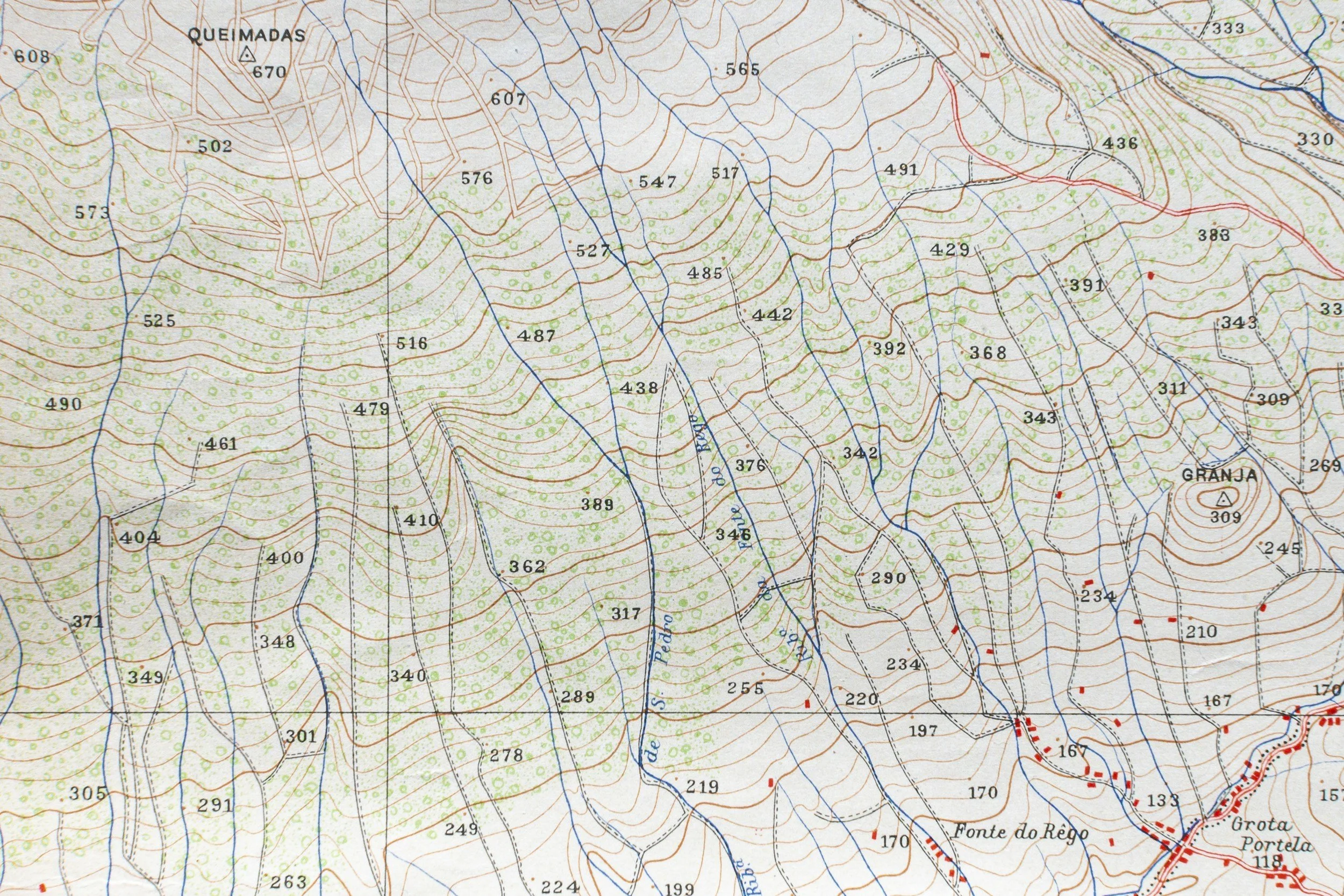
Using a historic quarry landscape as a working example, I developed analytical pipelines that applied Hexagon’s software to landscape architecture, archaeological interpretation, and site analysis. The demonstrations showed how the same spatial infrastructure used in mining operations could support heritage documentation, environmental assessment, and pre-development benchmarking.
This project demonstrated how terrain-linked operational data can reveal new markets, uncover opportunities for product extension, and guide strategic decisions, showing both platform developers and users how to generate more value from existing tools.
This work also introduced a method for benchmarking quarry and industrial landscapes prior to development or reclamation, allowing operators and planners to document spatial and environmental conditions at a level of detail that supports long-term stewardship and planning across the life cycle of a site.
Outcome
Demonstrated new analytical and planning applications for terrain intelligence software
Helped clients recognize additional value within existing spatial data pipelines
Introduced benchmarking approaches for quarry and industrial landscapes
Revealed how terrain-derived datasets can support stewardship, planning, and development decisions
Provided Hexagon and its clients with a new framework for interpreting operational spatial data as a source of broader environmental and strategic insight
Turning Environmental and Operational Complexity into Strategic Clarity
During expansion, redevelopment, technology deployment, or shifts in stewardship, complex terrain, environmental conditions, and spatial data can create strategic uncertainty that standard analysis misses.
GEOCOG provides terrain intelligence, revealing hidden constraints and opportunities so leaders can make confident long-term decisions.
My work with Hexagon Mining shows how understanding terrain as a system shapes strategy, investment, and institutional direction across industrial, institutional, and research contexts.
Areas of Practice
GEOCOG applies a single methodology across three operational environments: land stewardship, terrain-linked industry, and high-complexity decision environments.
Interpretive Property & Landscape Studies
Application of terrain intelligence for long-horizon land stewardship.
CORE PRACTICE

For: Family offices, foundations, legacy estates, vineyards, orchards, conservation lands, diplomatic properties, and industrial holdings.
For many clients, the work begins with the land itself.
Interpretive Land Studies are deep readings of landscape structure, history, and experience. Through repeated field visits, archival research, and interdisciplinary synthesis, I document how geology, ecology, and human activity shape a place over time.
The result is an archival land volume that captures the character and structure of a property.
Clients gain a durable understanding of their land that supports stewardship, long-term planning, and generational knowledge transfer.
For estates, conservation lands, vineyards, and industrial properties, this work becomes the intellectual foundation for how the land is understood and managed.
Terrain Systems Intelligence
Application for organizations operating industrial or data-generating terrain.
APPLIED STRATEGIC FIELDCRAFT
For: Ag-Tech firms, industrial landholders, mining and quarry operators, and companies whose technologies interact with terrain.
Environmental, Operational, and Data Opportunity Analysis
Organizations that operate in physical terrain often generate significant environmental and spatial data through their work.
Much of this information contains unrealized value.
I analyze terrain-linked operations and the data they produce to identify new strategic opportunities. This may include recognizing patterns across landscapes, identifying new applications for existing datasets, or revealing ways environmental insight can support new capabilities and markets.
Clients gain a clearer understanding of how their systems interact with terrain and how the information they generate can extend their strategic reach.
APPLIED STRATEGIC FIELDCRAFT
Cognitive & Situational Mastery
Application for human decision-making within complex spatial environments.
For: Defense, security, and organizations operating in high-complexity environments.
UEI: U8CGZW7SGQV9 CAGE: 1Z1D6 Capabilities
Complex terrain and architectural design also shapes human perception and decision-making.
This work applies the same observational discipline used in landscape interpretation to the development of situational awareness in demanding environments both indoors and outdoors.
Through research-informed frameworks, scenario design, and training strategies, organizations strengthen their ability to perceive, interpret, and act within dynamic spatial systems.
Participants develop the mental models and observational practices required for confident rapid decision-making in complex terrain.
The Value of Strategic Fieldcraft
GEOCOG uncovers actionable structure in complex environments, turning terrain, operations, and data into clear pathways for decision-making.
What working with GEOCOG delivers:
Clarity
A precise understanding of landscapes, operational systems, and spatial data: what’s truly influencing outcomes on the ground.
Stewardship Intelligence
Knowledge that guides long-term care and management of land, infrastructure, and resources.
Strategic Leverage
Practical ways to apply existing capabilities, data, and environmental understanding to solve challenges, improve operations, and explore new opportunities.
Durable Reference
Field-based analyses and documentation that remain actionable for years, supporting repeatable, confident decisions.
The result: teams know not just what is happening, but why, where opportunities lie, and how to act decisively.
A Different Way of Seeing Complex Environments
Land, operations, and the data they generate contain hidden patterns that only careful observation can reveal.
I help clients see how landscapes, activities, and information interact, uncovering opportunities for stewardship, strategy, and development that conventional analysis misses.
The principle is simple: observe deeply, interpret structure, reveal possibility.

Ryan Dewey
Principal Investigator
Ryan Dewey is a landscape systems researcher whose work investigates how terrain, operations, and spatial data reveal deeper structure within complex environments. His research integrates field observation, cognitive science, and systems architecture to understand how humans perceive, interpret, and act within operational landscapes.
Dewey develops analytical frameworks that translate terrain-derived information into strategic insight, enabling organizations to identify hidden patterns, overlooked opportunities, and structural constraints within the environments where they operate.
He is a visiting scholar in cognitive science at Case Western Reserve University, and his research archive is stewarded by the Center for Art + Environment at the Nevada Museum of Art. Dewey has collaborated with terrain intelligence technology firms and contributed research exploring how operational landscapes can be interpreted as structured systems, revealing overlooked opportunities and strategic value embedded within terrain-derived data.
Begin the Conversation
If you are responsible for land, operations, or terrain-linked systems and would like to explore what deeper insight into them could reveal, I welcome the opportunity to speak.