Glacial Grooves as a systems trace
Photogrammetric 3D Reconstruction & Wide Context Analysis
Kelleys Island, Ohio | 2022–2025
CONTEXT
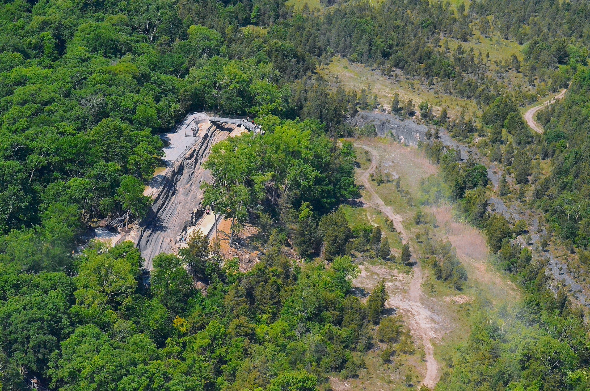
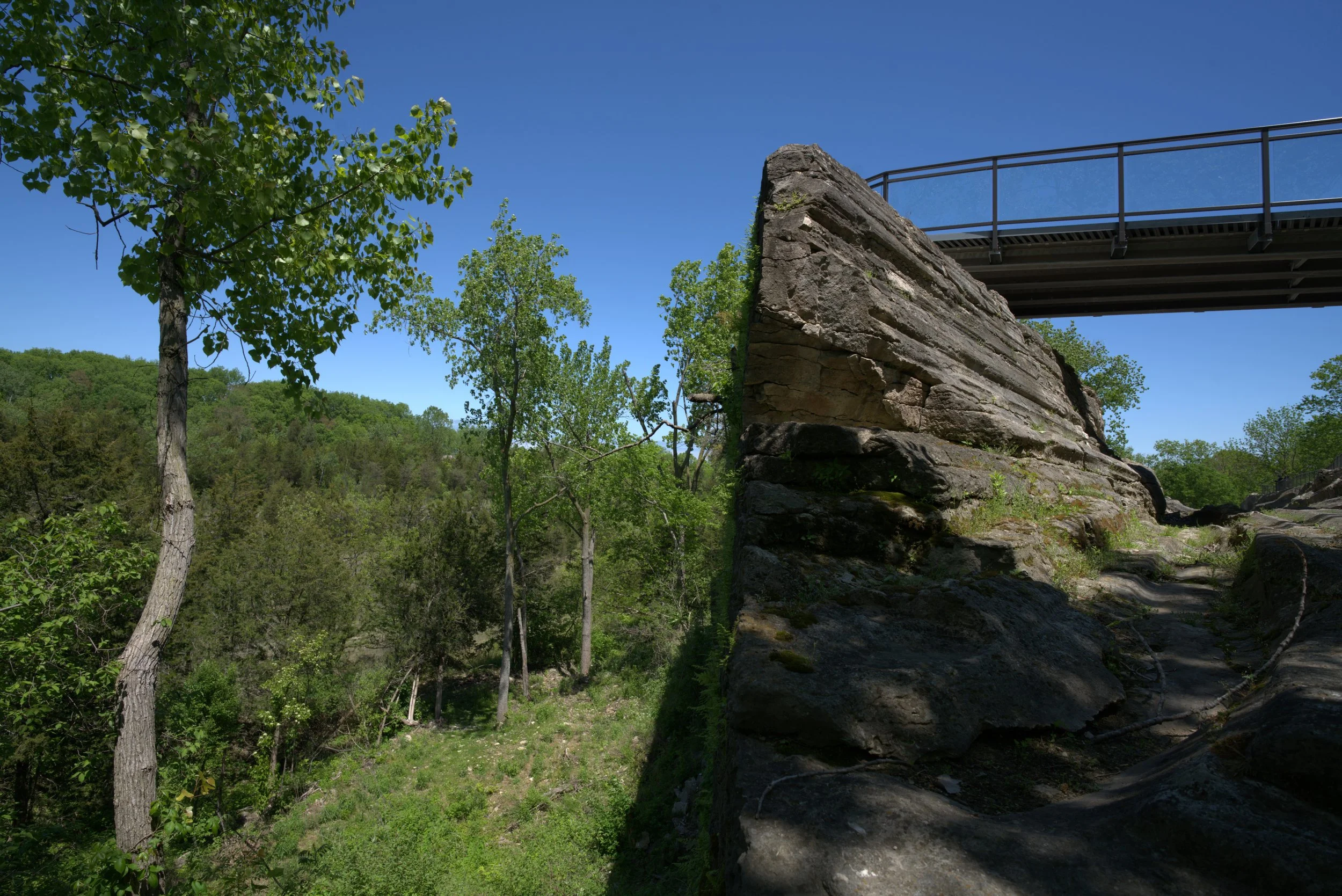
At the Kelleys Island Glacial Grooves, I developed a forensic-scale photogrammetry model that maps their full erosional trajectory, revealing fine morphological shifts across space.
By reconstructing an archive of 19th & early 20th century imagery of the surrounding area now lost to quarrying, I connect this site to the broader basin-wide glacial dynamics across the Lake Erie Archipelago.

Field Methods
I conducted a forensic-scale 3D photogrammetric reconstruction of both primary and secondary grooves, capturing topographic fidelity at sub-centimeter resolution.
Slicing the model into cross-sections at systematic intervals enabled morphological profiling along flow vectors, while a composite archive of imagery (stereoscopic images & engravings) of adjacent lost groove systems (quarried in the 19th and 20th centuries) offered a temporal counterpoint.
I am actively integrating these elements into a basin-wide erosional model extending across the Lake Erie Archipelago showing the linkage of disparate groove systems and the submerged grooves that string them together.
Mesh Model
Mesh Resolution:
Vertices: 3,829,075
Edges: 11,469,902
Faces: 7,642,396
Triangles: 7,642,830
RYANDEWEY.ORG
Systems Built
High-fidelity 3D mesh reconstruction of full groove system
Sub-meter slicing for systematic cross-sectional analysis
Morphological change mapping across spatial distances
Hypothesized inflection points of erosional process transformation
Historical groove site overlays for lost system recovery
Basin-scale erosional path integration
Insights
Enabled testing of how glacial force regimes evolved across variable substrates
Located spatial markers where erosional state-changes likely occurred
Re-positioned the grooves within a dynamic continuum of environmental processes
Recovered high-fidelity fragments of a lost morphology previously removed through industrial quarrying
Extended the grooves’ relevance from spectacle to signal: a trace of planetary-scale movement
Reconstructing Absent Grooves
Glacial grooves on this island once extended far beyond the 400’ site that remains today. This groove system is part of a larger formation that was lost to quarrying. My work reconstructs their original configuration using historical records, photogrammetry, and site analysis to map what is missing and understand how the broader glacial landscape was shaped, altered, and partially erased. I am continuing to process this data as part of my ongoing project archive at the Nevada Museum of Art.

Applications Beyond the Archive
This reconstruction offers a prototype for how we might recover, model, and operationalize landscape-scale intelligence across multiple domains.
The same forensic tools and spatial reasoning used here apply directly to:
ISRU planning - in analog terrain and legacy sites
Quarry reclamation strategy - grounded in site-specific morphology
Agricultural systems mapping - where annual shifts in surface structures reveal patterns of erosion, disturbance, and renewal
Environmental forensics - where terrain becomes evidence of past intervention or latent potential
If you're navigating complex terrain (physical, industrial, or conceptual) and need exquisite systems analysis grounded in material evidence, drop me a note:
Have you seen the grooves?
Pluck one of these 2” embroidered patches. Ships from the studio. Limited run. $20 + shipping
